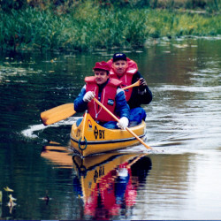
The project biking, paddling around Färnebofjärden National Park is a LEADER-funded project owned by the By Development Group together with development groups around Färnebofjärden.
Below is information about the resorts in the area.
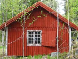
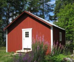
By
By is located in southern Dalarna. Here are the lakes, the attractive rural landscape, the wild rapids and the magnificent woods side by side. Come and swim at the natural beaches, rent a canoe or boat and head out to the pristine islands. Challenge the fish in the rivers and lakes, hiking in berry- and mushroom-rich woodlands. Or just enjoy the beautiful scenery of the old mining- and agricultural district!
Dalälven leaves its mark on nature. The huge river flows quietly and wide, here and there widening to lakes and bays, when leaving By exiting through the flowing Tyttbo rapids, which are a part of Färnebofjärden National Park.
By has attracted people since the Stone Age. The magically shimmering blue slag stones that can be found here and there testify ancient iron industry and the stately miner farms tells of a time of greatness.
Here we meet the northern wide forest, rustling deciduous groves in a gently rolling landscape.
Here the north coming Ural owl will meet the south coming Tawny owl. Here blooms the Arctic raspberry and Primrose side by side. Here you meet beaver and osprey, or maybe you see a moose at dusk.
www.bysocken.com
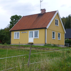
Österfärnebo
Österfärnebo parish has a very old origin with remains from the Stone Age. Österfärnebo parish is located around the Färnebofjärden flowing through the Dalälven river and around the northern part of the ridge Enköpingsåsen (Ockelboåsen).
The parish is crossed in a north-south direction by county road 272 (“The Road of Times”), which has had the same stretch since time immemorial. It is also crossed by the hiking trail Gästrikeleden.
In the area there is Gysinge nature reserve and Färnebofjärden national park with rushing water and Gysinge mill with very interesting to look at. Here is also Koversta old village, which is unusual as it has not been changed, ie the buildings remain in their original places. The village consists of buildings from the 17th / 18th century.
The nature is similar to that in Svealand but also has similarities with Norrland, here goes Limes Norrlandicus, the botanical Norrland border. Farthest to the west is the highest hill, Kungshögarna, where there is a lookout tower with a nice view. Also see www.osterfarnebo.com
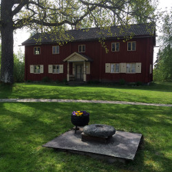
Gysinge
Gysinge belongs to Österfärnebo parish. Norrland’s southernmost outpost offers wild rapids and a unique natural heritage. Here ends the Uppland plains and the deep forests begins. some miles north are the mountains. Like a white pearl band is the old Walloon mill situated along the river bank.
One of Sweden’s most beautiful works is situated along rapids of Dalälven. The water swirls around the white buildings in summer and winter. The ice never manage to completely tame the vibrant power. The deep woods create a tranquil contrast to the wild rapids. The national park and nature reserve coms close to the beautiful stone houses.
Inside the ironworks area, nature is tamed to a beautiful park. The large mansion, built in the early 1800’s, situated in the middle. White stone meets lush vegetation. In the old industrial buildings thrives today new activities. The hammers are replaced with visitors chatter.
In Gysinge you need not choose between the experience of nature, culture and good food. Here are all gathered for generations. Combine a tour of the National Park with a visit to the small shops and one of Gysinges exhibitions. (Information taken from www.gysinge.se).
www.gysinge.se
Tärnsjö
The land around Tärnsjö began to rise from the Litorina Sea already about 6,000 years ago. First, the highest parts of the Enköpings ridge with a branch out towards Östa peninsula and an arm north through Tärnsjö. (This kind of ridge bifurcation is unique in Sweden.) Since then, the district had a rich history of extensive remains from the Stone Age to our modern history.
The focal point of the village was the church, which during the early Middle Ages was built on the shore of the bay, the present Färnebofjärden, which then reached up to the site of Nora Church. In the Middle Ages some villages were established in the area, eg Buckarby, Gäddsjö, Skärsjö, Ingbo and Östa.
At the end of the Middle Ages, the population is estimated to around 500, and into the 1800s, the population had increased to about 1,000 people. The district developed and had at the end of the 1900s almost 3,000 inhabitants, despite a large emigration to America in the mid-1900s. During the late 1900s’ incipient industrialization the parish’s first industry, Tärns steam sawmill and mill were built.
In 1901, Sala – Gysinge – Gavle railway is ready, with stations in Råsboda, Tärnsjö and Kerstinbo. Around the station in Tärnsjö grow a complete station village with post office and telegraph station, dairy, brewery, shops, factories and workshops. The population has decreased slightly, but in recent decades remained fairly constant at around 2,200 inhabitants.
(Information taken from http://www.tarnsjo.se/index.php?page=historia)
www.tarnsjo.se
Möklinta
The pearl in the silverdistrict.
Möklinta parish in Över-Tjurbo District comprises the north-eastern corner of Västmanland between Dalälven in the north and Sala in the south. In the east Möklinta borders Enåker and in the west Västerfärnebo.
The total area is 25,545 ha of which about 3800 hectares are fields and about 17 500 ha are forest. The major lakes are the Storsjön in the parish center, Hallaren in the east and the Storljusen in the southwestern part.
It means that visitors can walk in the countryside for a whole day without meeting other than the forest’s own residents. It is quiet and peaceful, no stress.
The people are friendly and welcoming – here you have time!
(Information taken from www.moklinta.se)
www.moklinta.se